Fishing Spots on Long Beach Island, New Jersey
Long Beach Island, NJ is a prime destination for surf fishing, pier fishing, crabbing, and back bay fishing. From Barnegat Inlet to Holgate, anglers can explore a variety of top fishing spots including public docks, jetties, marinas, and beach access points. Popular catches include striped bass, fluke, bluefish, weakfish, and kingfish. Whether you're saltwater fishing from shore or casting in the bays, LBI has year-round action for beginners and seasoned anglers alike. Always fish responsibly—leave each spot cleaner than you found it.
Please RESPECT all locations:
- Carry out what you carry in!
- Use common courtesy when driving in and out of residential areas!
- If an area is busy with anglers, it might be best to go back another time.
- Pay attention to other anglers and give them space!
- A polite attitude goes a long way.
North End Fishing
Barnegat Lighthouse State Park
- Old Barny Light House, Barnegat Light (N39.764352, W74.106227)
- Located at the northern tip of Long Beach Island, Barnegat Light offers a variety of fishing opportunities. The bayside, the Inlet and the surf (front beach) are all fishy areas for many different species during the year.
Barnegat Light's Inlet Jetty (aka South Jetty)
- Barnegat Inlet's Jetty (aka South Jetty) is a very productive area to fish any time of year for a variety of species. The most popular species are striped bass and bluefish as well as tog and fluke. Anglers fish the rips near the lighthouse and along the concrete walk way. Some explore and creep the jetty further out. Depending on the day, conditions and tide fishing can be great anywhere along the Jetty. Please use extreme caution when fishing the rocks especially when wet. Be safe and wear the appropriate footwear like Korkers jetty cleats to ensure footing.
Barnegat Light's Town Beaches
- Barnegat Light's Town Beaches (surf) are known for holding big trophy striped bass in the prime time season. These beaches are also great for fluke. Keep in mind some areas have very long dune paths to reach the water's edge.
Barnegat Light's Bayside
- Barnegat Light's Bayside has a large length of public bulkhead. This begins behind the Condos (4th and 5th Street) and continues to the area at the "end of the road" that is right outside the entrance to the park. This entire area can be very good and a great place with protection when the wind and swell have the Inlet churned up. In season tog fishing as well as fluke fishing here is very good. There are some snags in areas. This area can be great at night when the street lights draw in bait and feeding predators. Another area to fish the North End's bayside is the open area south of the Barnegat Light Bay Beach (light tackle fluke or top water bass) and High Bar Harbor Dike.
The Dike - High Bar Harbor
- The Dike at High Bar Harbor, Barnegat Light (N39.758111, W74.119707)
- The Dike is a peninsula of land that extends out into the bay offering anglers a variety of options. Fly fisherman love the diversity of the water from shallow rolling flats to deep fast moving water. Barnegat Bay's main thoroughfares Double Creek Channel and Oyster Creek Channel merge at its tip producing beautiful rippy water that is great for targeting striped bass as well as fluke, bluefish and weakfish. The Dike's close proximity to Barnegat Inlet is one of its key features. Any fish that moves in or out of Barnegat Bay by way of Barnegat Inlet has to move past the Dike. Fishing can be great on both the east and west side. Do not hike through the over grown trees. It is infested with poison ivy and ticks. CAUTION!!!
Harvey Cedars Bayside Pier
- Sunset Park, Harvey Cedars (N39.693943, W74.143886)
- Harvey Cedars Sunset Park has a pier for crabbing and fishing. It is located near the Harvey Cedars Water tower. The entrance to the park is at West Salem Ave. Harvey Cedars has a few public street ends that are great to explore for fishing and crabbing.
Mid-Island Fishing
Surf City Bayside
- Surf City has many public street end bulkheads that can be fished and crabbed. Some are better and have more space than others; 24th, 13th, 3rd, North 1st and Shore Ave, South 2nd.
- The Surf City Public Boat Ramp on the bayside of Division Ave has a small area on both sides of the ramp that can be utilized for fishing and crabbing.
Ship Bottom Bayside
- Our home town at the heart of Long Beach Island, Ship Bottom offers opportunity for vacationers and day trippers to fish and crab without traveling too far. The Rt 72 Causeway Bridges offers some of Long Beach Island's best and easiest fishing and crabbing access. There are numerous areas around and under all four bridges.
- Between 3rd and 4th street on the bay there is small yet spacious "Remembrance Park" with public parking with a dock/bulkhead. It is an area dedicated to the victims of 9/11.
- The 6th street bay area used to be an awesome fishing spot with a large and open sand lot. But LBI has experiences a lot of development over the decades. However there is a little spot that remains at the west end of 6th street.
- There is also an area on 5th with a Gazebo and benches but here is for sunset than fishing.
Robert Nissen Park (Ship Bottom Boat Ramp, Bayside)
- Robert Nissen Park (Ship Bottom Boat Ramp) is located on the bayside in Ship Bottom (10th - 12th Street) on the south side of the Causeway entering Long Beach Island. There is a large gravel lot for parking and there is a four plus block water front that can be fished.
- The Ship Bottom Fishing & Crabbing Pier is located next to the boat ramp. Depending on the season a variety of species are on tap. Anglers can fish with light tackle in the summer and target snapper bluefish, weakfish, fluke, blowfish, kingfish and spot.
- Also in the warmer month it is a great place to night fish for sharks and rays. In the fall and spring striped bass, bluefish and drum are frequently caught. The area is also a good winter flounder spot in season.
Beach Arlington Park (aka Sunset Point, Ship Bottom Bay Beach)
- Beach Arlington Park (aka Sunset Point, Ship Bottom Bay Beach) is located between 13th-16th on the bay in Ship Bottom. It is a summer time bathing "bay beach" area that is very popular among families, but in the offseason it can be a very good area to fish the bayside.
- It is best fished wading because it is shallow in close. There is a channel within casting distance. Certain times of year striped bass, bluefish, weakfish, fluke, blowfish and black drum are cruising the channel.
- It is a great place to launch a kayak to fish the eastern bridges and Ship Bottom's bayside islands.
Ship Bottom Crab Cove Pier
- Ship Bottom Crab Cove Pier is located on the on Central Ave between 25th and 26th Street in Ship Bottom. It is a great place to crab in the summer time.
- It usually isn't much of a fishing spot but at times in the summer it can have a few snappers.
- Get there early because it can be crazy mid day and especially on the weekends.
Long Beach Township
- Long Beach Township makes up a long stretch of the Island between Ship Bottom and Beach Haven. There are many public street ends that can be good for fishing and crabbing; 53rd, 59th Kimberly, 67th Pier at Bayview Park, Harrington, Jeanette, Bayberry, Jerome, Alabama, California, Hideaway Bay/Cove bulkhead and kayak launch, Colorado, Utah, Mac Evoy, Ramapo, Ohio, Indiana, 32-29, 15-13.
South End Fishing
Beach Haven - Public Docks
- The Queen City of LBI, Beach Haven has a large Public Dock area with phenomenal fishing. It is located at the west end of 2nd Street Dock Road. The bulkhead/boardwalk area has plenty of parking. The area offers some of the Island's best bayside fishing.
- Depending on the season, a variety of species are on tap. In the summertime it is a great place to target weakfish, striped bass, fluke as well as sharks at night. In the spring and fall stripers love to cruise the lights at night looking for small bait.
- There is also a public bay front area at west end of 9th and also Taylor Ave however it isn't great for fishing or crabbing. If trying here, it is better to use the northern end of the property just don't restrict access to the boat launch.
- Other spots to explore include Center, Engleside, Amber, Coral,
Holgate Wildlife Refuge
- Edwin B. Forsythe Holgate Unit, Long Beach Township (N39.531009, W74.263405)
Located at the southern tip of Long Beach Island, the Holgate Unit of the Edwin B. Forsythe National Wildlife Refuge is part of Forsythe’s designated Wilderness Area. It consists of more than 400 acres of barrier beaches, dunes and tidal salt marsh. One of New Jersey’s last remaining undeveloped barrier islands, this Natural Heritage Priority Site is an important and productive area for beach nesting birds. This site has also been designated a globally significant IBA by National Audubon for supporting breeding Piping Plovers.
Access to Holgate is subject to special regulations. Pedestrians are allowed only on the beach and must stay out of the dunes to protect this fragile habitat. Vehicles are not permitted above the high tide line and a permit must be obtained from Long Beach Township for access to the site. The Holgate Unit is usually open to beach buggies September 1 through March 31 or as posted. Information on current status of vehicle access and beach buggy permits can be obtained from Long Beach Township at (609) 361-1000 or the Long Beach Township Police Department at (609) 494-3322.
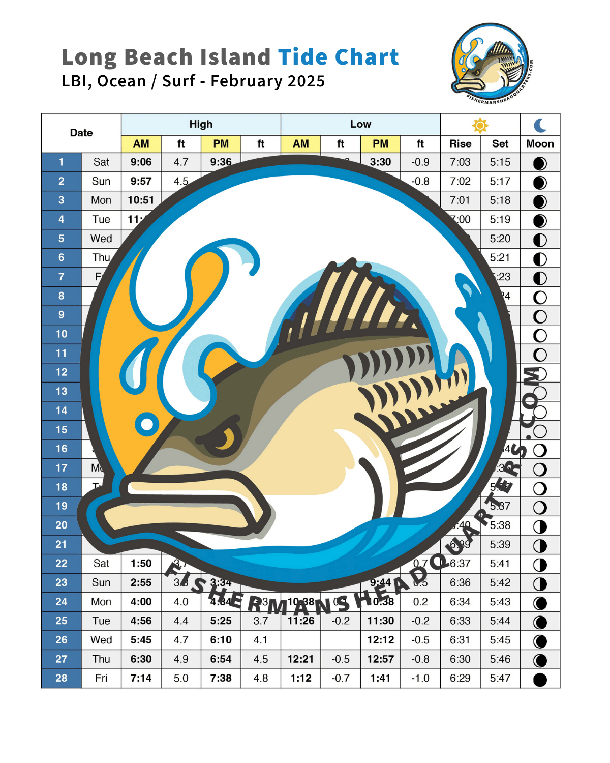
Holgate is a beautiful stretch of beach to fish during the day or night. It offers phenomenal fishing in the early fall during the mullet run (September) when bass, blues and fluke go crazy over mullet that are pouring out of the bay. The back side offers great clamming. Take note of daily tides and wind/swell forecast. Sometimes around the moons the extreme tides can steal beach fast, cutting off the driving path at certain spots. Sometimes anglers are trapped and have to stay until the next tide. Use extreme caution and always make sure you have enough gas.
Holgate is best fished via 4x4 (need permit) but there are opportunities for anglers without a beach buggy too. Take Long Beach Blvd south all the way to the parking lot at the end of the road. This lot is a good place to park for those looking to fish the front beach at spots like the Wooden Jetty and Beach One. Both are good fishing spots; however, during the daytime hours they are ruled by surfers. Beach One Jetty is straight off of Washington Ave and the Wooden Jetty is the next groin south. There is also a rock pile further south of the Wooden Jetty which was named by surfers, the Suicide Jetty.
Get Directions to Holgate Wildlife RefugeThe following are fishing spots on the mainland not far from Long Beach Island. The spots are listed from north to south.
Mainland Fishing Spots Near Long Beach Island (North to South)
Oyster Creek Outflow
Oyster Creek Rt. 9 Bridge — Lacey Township, NJ
(N39.811231, W74.199641)
The warm water discharge from the Oyster Creek Power Generating Station holds bait and fish year-round. Access is limited but highly productive for stripers, weakfish, bluefish, and winter flounder — even in the dead of winter. Hot baits include bloodworms, while productive lures are small bucktails, soft plastics, and small swimming plugs.
- Fishing Tips: Best fishing is from the east side of the bridge. Space is very limited and can be crowded. Do not fish the west side or wander near the plant — security is strict.
- Access: Cross the bridge and fish along the north bank of the creek. The mouth of the creek is productive but harder to access. Do not trespass on private property.
Directions: From LBI, take Rt. 9 North past Waretown toward Forked River. When you see the power plant smokestacks, you're close. Park on the south side of the bridge, east side of the street, either roadside or in the small dirt lot.
Get Directions to Oyster Creek Rt. 9 BridgeBarnegat Public Docks
Barnegat, NJ
(N39.749315, W74.192656)
The Barnegat Public Docks and Municipal Boat Ramp feature a large gravel parking lot and a long stretch of boardwalk/bulkhead along the bay. Known for crabbing, but also excellent for fishing.
- Fishing Tips: Snapper fishing is great during the day. Weakfish bite at night. In spring, bluefish blitz the bay — try casting poppers with a longer (8–9') light action plugging rod, especially at the nearby Barnegat Public Bay Beach (requires wading).
Directions: From LBI, take Rt. 9 North. In Barnegat, turn right onto East Bay Ave. Cross the small bridge — parking lot with two-story gazebo is on the right.
Get Directions to Barnegat Public DocksBridge to Nowhere
Stafford Township, NJ
(N39.683927, W74.207613)
Get Directions to Bridge to Nowhere
An old NJ Bell Telephone project from the '60s–'70s, now abandoned and popular for crabbing.
- Fishing Tips: Great crabbing spot. Be prepared for greenhead flies, especially in summer.
Directions: From LBI, take Rt. 72 West over the Causeway Bridges. Turn right at the first light (Marsha Drive), left onto East Bay Ave, right onto Hilliard Blvd, and then right onto Stafford Ave. The paved road turns to gravel — continue to the end.
Get Directions to Bridge to NowhereGraveling Point
Osborn Island, Little Egg Harbor Township, NJ
(N39.538612, W74.393345)
Part of the Edwin B. Forsythe National Wildlife Refuge. Famous for being one of the earliest spots to catch striped bass each year.
- Fishing Tips: Best on outgoing tide during March and April. Bloodworms are the bait of choice. Waders are highly recommended — you must cross a small creek to reach the point.
Directions: In Tuckerton, near the lake, turn left onto Great Bay Blvd. After about half a mile, turn right onto Radio Rd. Cross the small bridge and continue about 4 miles to the end. Walk west along the sand beach, cross the creek, and continue fishing along the sod bank.
Get Directions to Graveling PointSeven Bridges Road
Great Bay Blvd., Little Egg Harbor Township, NJ
(N39.509196, W74.320043)
Great Bay Blvd (aka Seven Bridges Road) is a scenic fishing and crabbing area with a great view of Atlantic City.
- Fishing Tips: Fish the bridges and surrounding areas — the first bridge and last two are especially popular. If the bridges are crowded, head to the end of the road and fish the trail banks.
The bridges cross (in order):
- Big Thorofare
- Little Thorofare
- Jimmies Creek
- Big Sheepshead Creek
- Little Sheepshead Creek
At the end of the road is the Old Coast Guard Station, now Rutgers University Marine Field Station (RUMFS).
Get Directions to Seven Bridges RoadCollins Cove
Port Republic, NJ
(N39.548247, W74.473983)
Located on the Mullica River just west of the Parkway Bridge, Collins Cove is a winter and early spring hotspot for white perch — and sometimes offers ice fishing in colder years.
- Fishing Tips: Target white perch during cold months, especially January and February.
Directions: Take Parkway Exit 48. This puts you onto Rt. 9 South. After about a half mile, turn right onto Rt. 575 (Chestnut Neck Road). After two miles, turn right onto Rt. 624 (Clark's Landing Road). Pass under both Parkway bridges. Take the first right onto a dirt road and drive parallel to the Parkway north until reaching the parking lot. Park, then hike less than a mile northeast to Collins Cove.
Get Directions to Collins Cove


 609-494-5739


